Kazbegi Mountain Marathon 2026: the Kazbegi trail through a participant's eyes
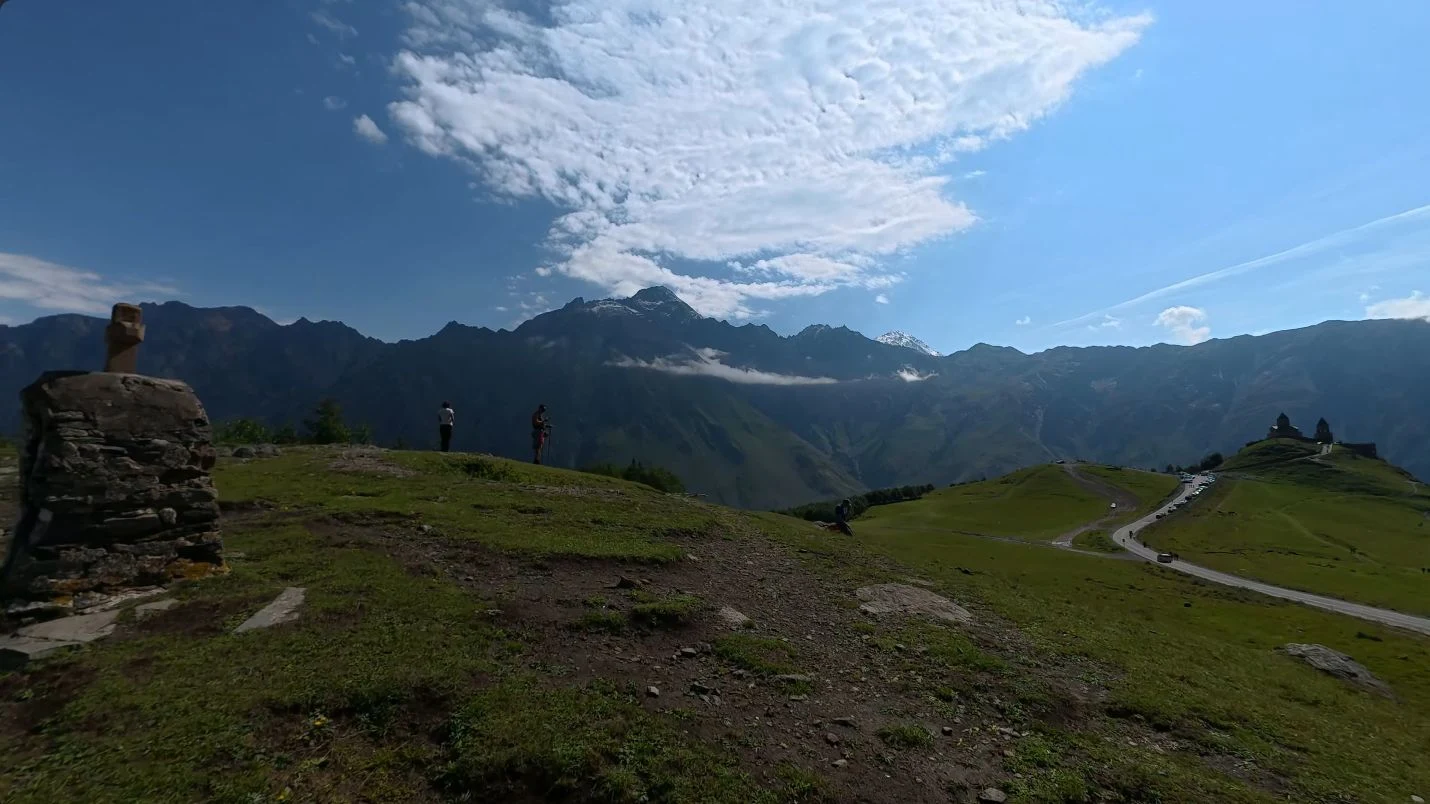
On August 30, 2026, I lined up at the start of the Kazbegi Mountain Marathon in Stepantsminda. Instead of the usual report with a pace table, I put together a 50-minute first-person film: from the start village to the finish arch, in chronological order.
If you want to understand what the Kazbegi trail looks like from the inside, start by watching the video. It's best viewed in 4K with sound: there's no music here, just footsteps, breathing, participants' voices, and the real sound of the mountain course.
What is the Kazbegi Mountain Marathon
The Kazbegi Mountain Marathon is a mountain trail race near Stepantsminda at the foot of Mount Kazbek. It's not a single route but several distances of varying difficulty: from a short introduction to trail running up to Extreme. The organizer places the start and finish of all distances near the lower Gergeti parking lot.
The main feature of this race isn't a single number in the elevation profile, but the constant change of terrain. Dirt gives way to rocks, the trail leads past houses and onto a road, an open valley turns into forest, and after the climb comes a long technical descent. That's exactly why I decided to show the course not as a highlight reel, but as a continuous POV video.
My Kazbegi trail: how the route changes
Start among the mountains
The first minutes show the starting area, the participants, and mountains all around. After the starting signal, the group quickly spreads out: the wide section ends, and the real mountain work begins. Already at around 04:15 you can see the race leaving the start and heading toward the trails.
Climbing through villages and stone houses
Further on, the route passes through mountain settlements. Underfoot is an uneven road, old stone walls stand nearby, and the incline pushes some participants to switch to a fast walk and use poles. In the video, this section starts at around 16:40.
This is where the difference between a regular city race and trail running really stands out: speed stops being the only measure of progress. It's important to choose an effort level that lets you keep climbing without losing control on the descent.
Forest, road, and open mountains again
After the sunlit slopes, the course briefly dips into the shade of trees, then comes out onto a road. The footage shows cars, participants on the roadside, and an aid station along the route. This is a short connecting section before the most spectacular part.
Around 29:15 the landscape opens up: a ridge appears ahead, clouds sit below the peaks, and the Gergeti Trinity Church is visible on a hill. It's for shots like this that you want to put the video on a big screen.
The long rocky descent
From 33:25 the long descent begins. The trail is narrow, with small and large rocks underfoot, and a deep valley opens up to the side. Sometimes regular hikers with big backpacks appear coming the other way — the race route remains a living mountain trail, not a closed stadium.
This is one of those sections where the beautiful view constantly competes for attention with the surface underfoot. The camera conveys the slope better than a still photo: you can see why stability and control matter on a descent like this, not just speed.
Through the village — to the finish
Closer to the end, houses and very rocky passages appear again. Then the route returns to an open valley: a narrow trail runs along the slope, green fields remain below, and the finish already feels close. At 49:50 the arch appears — after almost fifty minutes of on-screen travel, the loop closes right there, among the mountains.
What stands out especially well in the video
- the real surface: dirt, gravel, large rocks, road, and narrow trails;
- how often the incline and width of the route change;
- where participants run and where it makes more sense to switch to a walk;
- open sections with no shade and cooler forest stretches;
- the length of the descent and how close the course passes to the villages;
- the atmosphere of the start and finish without a music-video-style edit or promotional cut.
If you're choosing a distance or preparing for the Kazbegi Mountain Marathon, watching this is more useful than a short trailer: in 50 minutes you can assess not just the views, but also the surface, the movement of other participants, and the character of the course.
What to keep in mind before the next Kazbegi Trail
Routes and requirements change from year to year, so before registering you should check the current TRAILLAB rules, download the latest GPX file, and check the mandatory gear for your specific distance. The gear list is stricter for SkyRace and Extreme; the organizer allows trekking poles on all distances.
From my own footage, I'd highlight three practical points: your shoes need to grip confidently on rocks, it's best to pace your effort on the climb in advance, and the long descent requires concentration right to the end. Mountain weather changes quickly, so one sunny video doesn't replace checking the forecast and the rules before the start.
Why watch the full route
This film isn't a tutorial or an attempt to make a hard trail look easy. I wanted to preserve the day the way it felt from the inside: the crowd at the start, the slow climb, the Caucasus right in front of you, rocks on the descent, and the finish arch at the end.
If trail running, mountain races, and Georgia speak to you, watch the full video on YouTube, leave a like, and let me know in the comments which section you'd most like to run yourself.